Friday, May 21, 2010


Zefat

I visited this city during our April 2010 trip to Israel and Jordan. Israel has so many different climate zones, and this one is probably the most beautiful for someone who grew up in a cold weather climate, like myself.


From Wikipedia, the free encyclopedia:

Safed (Tzfat; ᚢafad), also known as Zefat, is a city in the northern part of Israel. Located at an altitude of 900 metres (2,953 ft), Zefat is the highest city in the Galilee and of Israel. Due to its high altitude, Zefat experiences warm summers and cold, and often snowy winters. Since the sixteenth century, Zefat has been considered one of Judaism's Four Holy Cities, along with Jerusalem, Hebron and Tiberias.  
We went to this city in the evening, and the pictures were taken when it was already dark.


Sunset view.

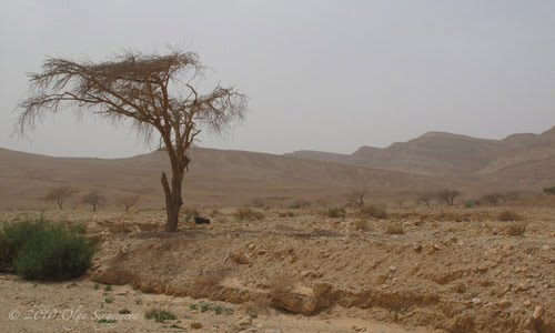
The view of the Lake Kinneret (Sea of Galilee, also Lake of Gennesaret).
The city has an Ashkenazi Quarter and a Sepahardic quarter, where you can see people in traditional black suits and hats. Women wear long skirts and hats, too. There is also an area with the art galleries, a big tourists attraction.


The city of Zefat may look differently when lighted by a sunshine, but it will always remain in my memory filled with this golden light from the street light poles, with those beautiful reflections on the ancient stone pavement, and with those quiet streets filled with a fresh mountain air.

To be continued with short stories about Jordan, Akko, animals etc.


Thursday, May 20, 2010


Negev Desert, Israel.
April 2010.

We went from Akko at the North to Eilat at the South by car, and crossed the Negev desert twice. We  also had a unique opportunity to see a desert in bloom.

Khamsin, this dry, hot and dusty wind was blowing on the day of our trip to the North, it was a surreal and interesting experience. Most of my pictures were taken from the car, because I was afraid that all this dust and sand could damage the camera.
On our way South we've also made a detour to the Dead Sea.


+200 m mark over the Dead Sea level.


This was the only big tree that we saw on our way to the Dead sea.

Dead Sea view from the car.


Dead Sea View. This part of it is used for the beauty products production, that's why it is divided into parts with visible borders.


Beauty products factory on the Dead Sea shore


Sand storm approaching


Blooming Desert


 Igor was brave enough to get out of the car and go to the trees with his tripod and camera.


The sandy wind is visible on the background.


To our surprise, in the middle of a desert there was a rest stop with McDonald's restaurant, We were hungry and used this opportunity. The food was no different from our local McDonald's, which was a shame, because Israeli food usually is pretty good.

The wind was very strong and the sand was literally stabbing the skin.


Those pictures with a blue sky were taken on our way back, on April 14th, 2010.
Painted Hills


Oasis in the desert


Negev Desert, military forces in training. Tank tracks prints.


A monument on the top of a mountain. Those mountains form a crater looking like a surface of the Moon.


Chopper on the hill.

Way to nowhere...


State Park named The Carpentery


Israeli Stonehedge


Crater's Bottom


Rock Climbers

Camel, a real one. Bedouin village was near, he was feeding himself in the desert.
Camels, sculptures on the hill tops. They look very decorative in the desert.


A picture is worth a thousand words, so I hope you were able to see the desert through the lens of my camera and realize how big, empty and deadly place it is. The flowers pictured above appear only in the springtime, and don't last long. The desert itself is a rocky, stony and empty space, not suitable for life.
We found only one puddle with water, that looked suspiciously green, so I believe it wasn't water, but some kind of a poisonous salty liquid.


My next posts will include Jordan, Agaba, Jordanian Desert, animals, cities of Israel and more.